


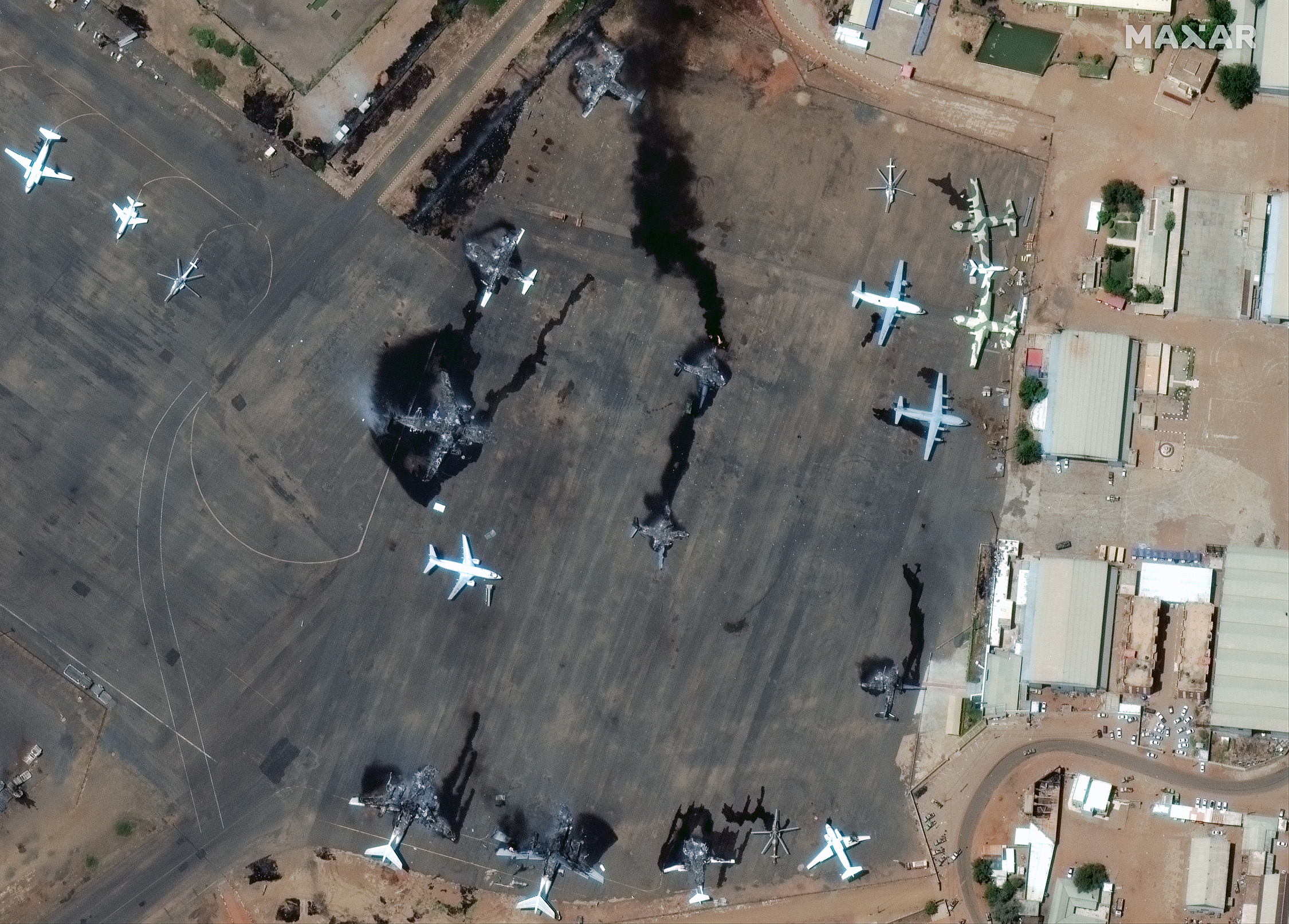
Maxar Technologies’ satellite imagery has revealed the extent of the damage caused by clashes between rival military factions in Sudan. The fighting, which began on 15 April, has seen battles break out across the country as a power struggle between the army and paramilitary Rapid Support Forces (RSF) turned violent. Images from Maxar’s satellites show damaged and destroyed planes at Khartoum International Airport and at Merowe Airbase, located around 200 miles north of the capital. Reports suggest that attempts at a 24-hour ceasefire have failed, with fighting continuing into Wednesday.


