


“We’re delighted to be working on a major domestic mineral exploration project with a fellow Australian-owned company. ExoSphere gives Infinity Mining a unique opportunity to use our advanced ANT technology to map possible lithium-bearing pegmatites, potential host rocks and controlling structures at depth. The system is ideally suited to the rugged terrain of Pilbara, where our Geodes’ light weight and portability really come into their own. Combined with Infinity’s existing data, the ANT data will give the team a better understanding of Tambourah South’s overall geology, aiding drill targeting and speeding up the development of commercially-viable deposits of these vital minerals.”
Flavia Tata Nardini, CEO & Co-Founder, Fleet Space Technologies
Infinity Mining will deploy Fleet Space’s ExoSphere, to enhance mineral exploration activities and decrease time spent exploring for deposits of lithium, rubidium, and rare earth elements at Tambourah South.
The use of ExoSphere will significantly reduce the amount of scout drilling required, saving time and resources as LCT pegmatites follow structures within greenstone units making them elusive and difficult to find using established drilling protocols.
These minerals play a crucial role in several industries, including the transition to renewable energy. ExoSphere’s advanced capabilities will allow Infinity Mining to explore deeper and more thoroughly, improving the likelihood of discovering previously untapped mineral deposits. The successful deployment and delivery of ExoSphere at Tambourah South could pave the way for more efficient and effective mineral exploration across the Pilbara’s rouged terrain.
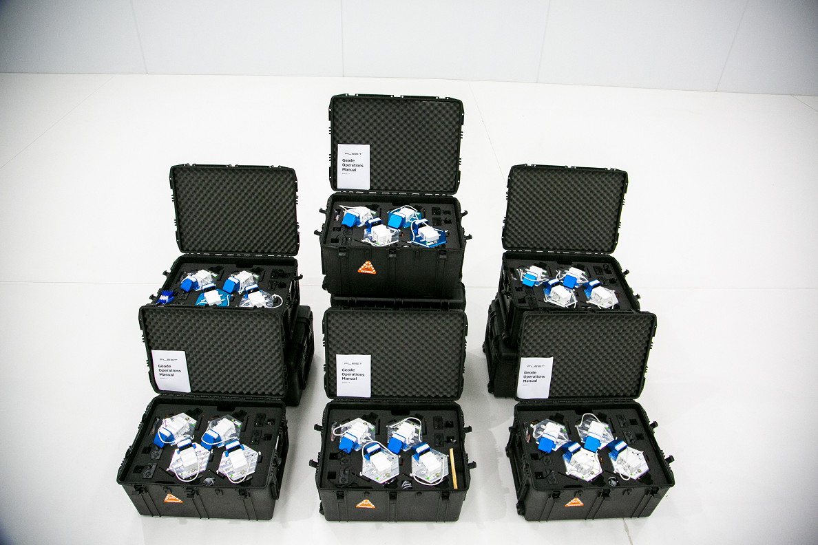
ExoSphere consists of real-time, satellite-enabled seismic nodes specifically designed for mineral exploration in remote settings called Geodes. The Ambient Seismic Noise (ANT) data is transmitted to a constellation of low earth orbit (LEO) satellites, then relayed to computers that use intelligent data processing to generate detailed 3D subsurface maps. The combination of Geodes and satellite connectivity allows small teams to map vast amounts of land accurately and with little to no environmental disturbance. Plus, unlike traditional methods, which can take months to years to complete, data collection and processing can be completed in a matter of days.
ANT will enable Infinity Mining to map where lithium-bearing pegmatites identified at the surface are going at depth, if they are thickening up and whether they are merging with other pegmatites. It will also help identify concealed pegmatites that don’t have surface expressions, and provide 3D mapping of favourable host rock units and structural controls on pegmatite development.


