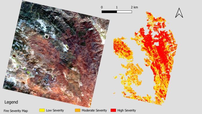
The ASI-funded project “Sviluppo di Prodotti Iperspettrali Prototipali Evoluti” has developed the prototype processor “Fire Severity Map.” The main objective of the project was to prototype various L3/L4 value-added products using PRISMA hyperspectral data.
The image displayed is an RGB representation of PRISMA data collected in California, specifically in the counties of Napa, Sonoma, Lake, Yolo, and Solano. The image depicts a fire incident known as Hennessey, which started on August 17th, 2020, and was reported contained on September 16th, 2020, according to the Department of Forestry and Fire Protection – Fire and Resource Assessment Program of the State of California.
On the right side of the image, there is a classification of the burnt area based on the severity of the environmental changes caused by the fire.
The data/information in the image was generated by Planetek Italia under an ASI License to Use. It is an original PRISMA product copyrighted by ASI (2021).
To download the full frame image in jpg format, click here: [Download Link].


 Copyright 2023 All rights reserved.