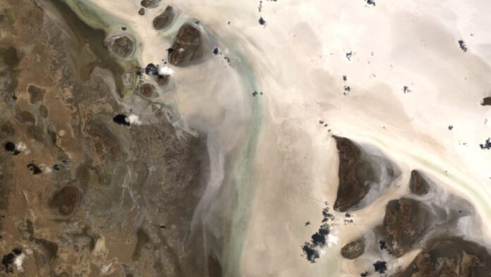
The Uyuni Salar, located in the Bolivian altiplano, is the largest salt flat in the world. A recent satellite image captured by PRISMA in January 2021 shows a portion of the salt flat border north of the Estancia Ajia village.
The surface of the Salar is known for its flatness and high albedo, with small lakes and islands formed from ancient coral reefs dotting the landscape. Cloud shadows can be clearly seen over the white surface, making it an ideal location for satellite sensor calibration.
In addition to its unique properties, the Uyuni Salt Flats are also rich in salts and hold one of the world’s largest lithium reserves. This element is crucial for manufacturing electronic devices, making the Salar a significant economic resource for Bolivia.
The data and information in the image were generated by F. Serva and L. Ansalone under an ASI License to Use. The full frame image can be downloaded for further analysis.


 Copyright 2023 All rights reserved.